 Padua City Guide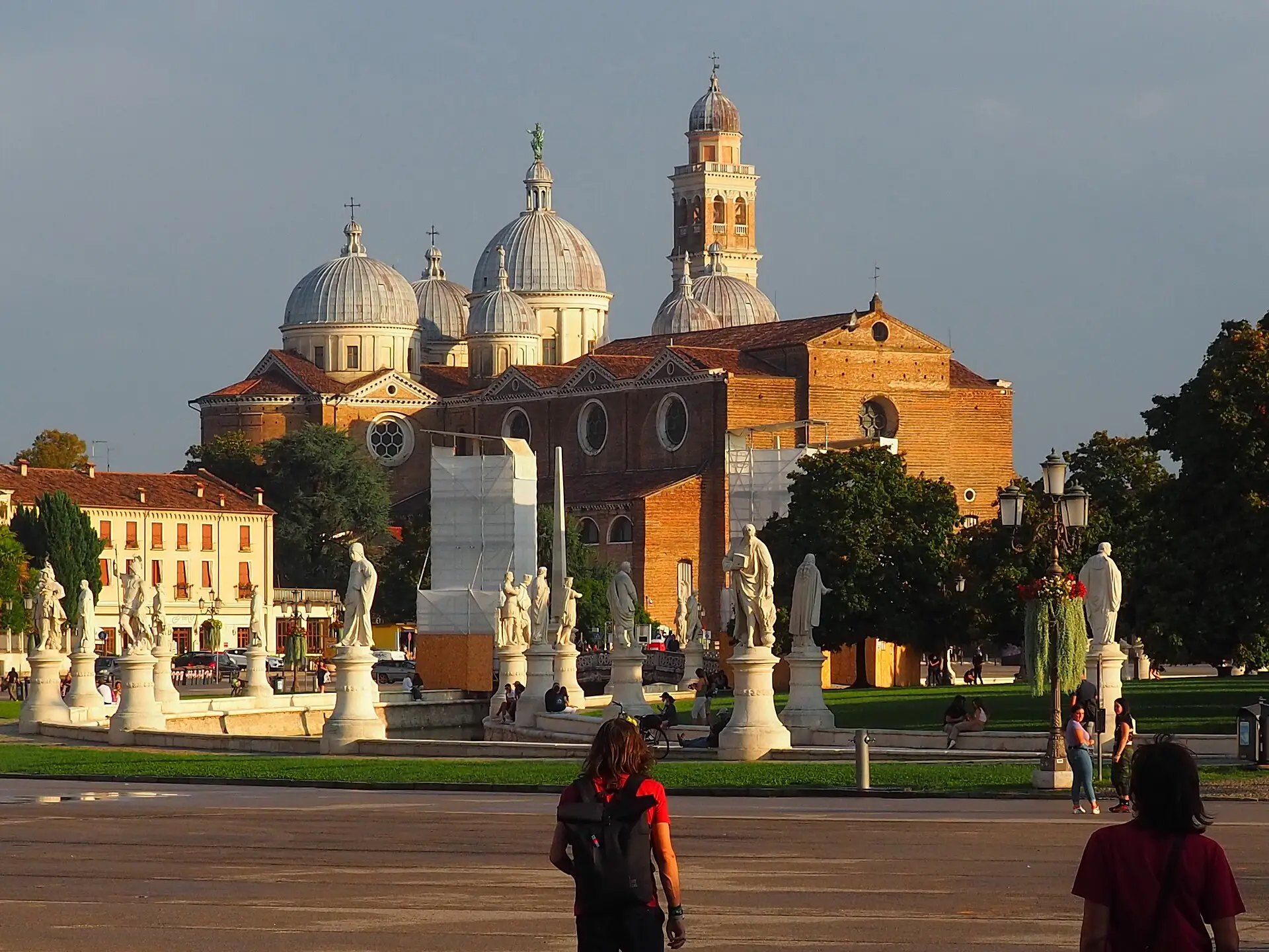
An interactive padua map does more work here than in most Italian art cities, because Padua's old town is small, dense and layered in a way that is easy to read once you see it plotted: Giotto's chapel and the Roman arena at the north edge, the medieval market squares at the hinge, the ecclesiastical city of the Duomo, the Santo and Prato della Valle to the south, and a ring of walls, promenades and railway holding it all together. This page plots 36 verified pins in five categories — monuments and heritage, museums and frescoes, parks and river, food and dining, transit and parking — each with an exact price or a plain Free, a practical note on hours and logistics, and a link to the guide that goes deeper. Use it before you go to sequence the days, and on the ground to find the nearest bacaro, gate or garage. Walking times between the key pins are tabulated below, and the parking section explains where a car can actually go. The rest of the city directory sits on the Padua City Guide homepage.
Quick answer How the map is organised, walking scale and the one booking that needs lead time
Read on 12 September 2026: this map plots 36 pins across five categories — Monuments & Heritage, Museums & Frescoes, Parks, Hills & River, Iconic Food & Dining, and Transit & Parking — centred on the medieval squares. Every pin carries an exact 2026 price or says Free, and links to a full guide. The core is compact: most mapped pairs sit within 15 minutes' walk of each other, and only the station district sits outside that radius. The one pin with a hard booking rule is the Scrovegni Chapel — timed 15-minute slots, book ahead via Scrovegni Chapel tickets — and the tram, bus and parking mechanics are set out on getting around.
Key takeaways
- Book the chapel first: the Scrovegni's timed 15-minute slots are the only thing on this map that needs real lead time.
- One Urbs Picta Card covers eight UNESCO sites plus transport — 48h €28 or 72h €35 — and the honest arithmetic is on is the Padua Card worth it.
- Everything inside the walls is walkable: basilica to botanical garden takes about 20 minutes end to end, with Prato della Valle in between.
- Cars stop at the ring: perimeter garages such as the Piazza dell'Insurrezione area replace driving in the restricted core.
- Markets run on weekday mornings only — about 07:30-13:00 on the two squares — so time the food pins accordingly.
Interactive Padua city map: 36 pins across five categories
Filter by category to isolate monuments, museums, green space, food or transit; each numbered pin carries its price, a logistics note and a link to the matching guide. The centre sits on the medieval squares, zoom level 15:
Monuments & Heritage 12 pins
- Scrovegni Chapel (Cappella degli Scrovegni)€16.00 combined ticket (chapel + Eremitani museums)Giotto's fresco cycle of 1303-1305, built into the ruins of the Roman arena at the city's north edge. Open 09:00-19:00 daily; every visitor gets a timed 15-minute slot, so book ahead.
- Piazza delle ErbeFree public squareThe central market square, trading on weekday mornings from about 07:30 to 13:00, ringed by arcades, bacari and the mass of the Palazzo della Ragione.
- Palazzo della Ragione (il Salone)€8.00The great medieval law court above the markets — 09:00-19:00 Tuesday-Sunday, closed non-holiday Mondays — with one of Europe's largest painted halls covering its walls.
- Piazza dei SignoriFree public squarePadua's most elegant square: the Dante statue, the Gran Guardia loggia and the café tables where the evening drift of the centre comes to rest.
- Torre dell'OrologioFree (donation welcome)The astronomical clock tower (1344) closing the square's north side. Visits run at fixed times and must be booked; a donation is asked rather than a ticket.
- Duomo (Cathedral of Santa Maria Assunta)Free entryThe city cathedral beside the baptistery, with an unfinished Renaissance facade and a cool, plain interior. Open daily; services take priority at mass times.
- Baptistery of the Duomo€15.00 combo with the Diocesan MuseumA small brick baptismal hall under Giusto de' Menabuoi's fresco dome of the 1370s — among the finest painted interiors in the city, ticketed together with the Diocesan Museum.
- Palazzo Bo (University of Padua)€10.00 guided tour (weekdays)The university's historic seat, founded in 1222. Weekday guided tours include the 1594 anatomical theatre and the lectern Galileo used while teaching here, 1592-1610.
- Basilica of Saint Anthony (il Santo)Free (museum complex €10.00)The great pilgrimage basilica at the city's south-east corner, free to enter, with Donatello bronzes on the high altar and the saint's tomb in the chapels below.
- Abbey of Santa GiustinaFree entryA vast abbey church east of Prato della Valle, holding the tombs of several saints, side chapels and quiet cloisters behind — the least crowded of the big interiors.
- Loggia AmuleaFree exteriorThe neo-Gothic loggia on Prato della Valle's south-west corner, floodlit after dark and the square's best photograph from the abbey side.
- Porta PortelloFree exteriorThe 16th-century gate in the north-west wall where the Brenta navigation canal entered the city — the start of the Riviera dei Ponti walk and the quietest edge of the old town.
Museums & Frescoes 6 pins
- Musei Civici agli EremitaniIncluded in the €16.00 combined ticketThe city museums beside the Scrovegni Chapel: archaeology from the Veneto plain plus medieval-to-modern art. The adjacent Church of the Eremitani holds Mantegna's restored Ovetari Chapel frescoes.
- La Specola (Astronomical Observatory)Free exterior; guided interior visits onlyA 14th-century tower on the Bacchiglione bend that served as the university observatory from 1777. The interior opens only on guided visits at fixed times — book ahead.
- MUSME, Museum of the History of Medicine€12.00 adultInteractive medical-history museum in the old San Francesco Grande hospital, Via San Francesco 94. Tuesday-Friday from 14:30, weekends and holidays from 09:30; last admission 18:00.
- Museo Antoniano (Basilica museum complex)€10.00The Santo's museum complex beside the basilica: Donatello bronzes, Giotto fresco fragments and the treasury, ticketed together on one €10.00 entry.
- Diocesan Museum€15.00 combo with the BaptisteryThe diocese's collections behind the Duomo — silver, vestments and painted panels — on the same combined ticket as the frescoed baptistery next door.
- Sala dei GigantiFree (university opening hours)A 14th-century frescoed hall on Piazza Capitaniato, now a university reading room; when the doors are open you walk in free and read the walls as well as the books.
Parks, Hills & River 6 pins
- Giardini dell'ArenaFree public parkA public park folded over the oval of the Roman amphitheatre behind the Scrovegni Chapel — picnic lawns with the arena's curved outline still readable at ground level.
- Prato della ValleFree public squareItaly's largest square at about 90,000 m²: a canal ring, an island of lawns and 78 statues of Paduan worthies. Best crossed on foot in the late afternoon.
- Orto Botanico€15.00 (€12.00 winter)The world's oldest academic botanical garden (1545), UNESCO-listed since 1997. Closed on ordinary Mondays; the winter rate drops to €12.00.
- Bacchiglione riverwalk (Lungargine Rovetta)Free waterfrontA willow-lined towpath along the Piovego branch north-west of the walls, from Porta Portello towards Ponte dei Tadi — the city's quietest waterside hour.
- Riviera dei PontiFree promenadeThe tree-lined promenade inside the north walls along the filled canal bed, linking Porta Portello to Ponte Altinate — shade, parking and almost no monuments to queue for.
- Parco della RotondaFree public parkThe green wedge between the two Bacchiglione branches just south of Prato della Valle — playgrounds, picnic grass and a calm backstop to the square's crowds.
Iconic Food & Dining 6 pins
- Piazza delle Erbe market stallsFree to browseWeekday produce, cheese and fish stalls from about 07:30 to 13:00 under the Salone — assemble a market lunch for €5.00-10.00 and eat it on the steps.
- Piazza della FruttaFree public squareThe second market square, north of the Palazzo della Ragione: produce stalls by day, bacari counters spilling into the arcades from about 18:00.
- Caffè PedrocchiCafé free; museum €5.00 (Tue-Sun)The historic café of 1831, open 08:00-24:00 daily with no entry fee; the Piano Nobile museum upstairs costs €5.00 Tuesday-Sunday. Order the green mint coffee once.
- Bacaro strip: Via Soncin and Via dell'ArcoCichetti €1.50-4.00 a plateThe densest counter strip behind the market squares — baccalà mantecato, polpette and small glasses, eaten standing, from about 18:00 to 22:00.
- Via Roma café beltEspresso €1.20-1.60 al bancoThe shopping street's cafés and pasticcerie running south from Caffè Pedrocchi; table service adds a visible step to the bill the moment you sit.
- Osterie around Piazza dei SignoriPrimi €8.00-13.00Fixed-menu osterie and the evening drift on the lanes north of Piazza dei Signori; guided food tours also meet in this cluster before setting off.
Transit & Parking 6 pins
- Padova Centrale railway stationFree to enterThe city's rail hub: Venice about 30 minutes away (regional tickets roughly €4-5), Verona and Bologna 70-90 minutes, Vicenza about 30. An IAT desk sits in the atrium.
- Autostazione (bus station)Free to enterThe bus terminal beside the railway station — city buses, the tram interchange and regional departures, with ticket machines at the bays.
- Venice airport bus stop (Autostazione)€13.00 one-way adultThe airport express to Venice Marco Polo leaves about every 40 minutes and takes roughly 45 minutes. Buy before boarding — the driver-ticket surcharge is real money.
- Taxi rank, Padova CentraleMetered faresThe rank at the station forecourt; the old town is about ten minutes by meter. For the Santo or Prato della Valle, ask for the nearest motorable drop-off — the core is restricted.
- Underground parking near Piazza dell'InsurrezioneHourly tariff — check at the barrierA large underground car park just outside the restricted historic core at the Pedrocchi end of Via Roma — among the closest parking to the centre. Confirm tariffs and height limits on the signage.
- IAT tourist information, Piazza delle Erbe 52Free maps and adviceThe city's main tourist office in the square's arcades, with a second desk in the station atrium — free paper maps, Urbs Picta Card sales and opening-hour answers.
The five map categories at a glance
Every pin above belongs to one of five colour-coded categories; the counts below match the pins exactly as plotted on this page on 12 September 2026, and the final column names the single pin that anchors each category for a first visit.
| Category | Pins | What it covers | Where it clusters | Start with |
|---|---|---|---|---|
| Monuments & Heritage | 12 | Squares, basilicas, gates, towers and the university seat | The market-square hinge and the south-east quarter | Scrovegni Chapel |
| Museums & Frescoes | 6 | Civic, diocesan, university and medical museums | The Eremitani complex and the river bend | Musei Civici agli Eremitani |
| Parks, Hills & River | 6 | The great square, gardens and waterside walks | The southern edge and the north-west walls | Prato della Valle |
| Iconic Food & Dining | 6 | Markets, bacari, historic cafés and osterie | The two market squares and the Via Roma belt | Caffè Pedrocchi |
| Transit & Parking | 6 | Station, buses, airport link, taxis, parking, tourist office | The station district and the market square | Padova Centrale |
Urban geography: the Bacchiglione, the piazze, and the ring
Padua is a river city that hides its river well. The Bacchiglione enters from the south-west, once wrapped the medieval walls in a double bend, and now reaches the centre mainly as the straight Piovego cut in the north-west, where Porta Portello marks the old canal mouth. What the water left behind is a three-layer plan, and the map above makes each layer visible as a cluster of pins.
The northern layer is the ancient city. The Roman amphitheatre's oval survives as the shape of the Giardini dell'Arena, and the chapel that holds Giotto's 1303-1305 frescoes was built into the arena's remains — which is why the city's most-visited painting cycle stands on what looks like a quiet park edge rather than a piazza. The Musei Civici and the Church of the Eremitani complete that quarter.
The hinge is the market complex. Piazza delle Erbe and Piazza della Frutta sit under the great hall of the Palazzo della Ragione, and Piazza dei Signori opens off them to the north-west, with the clock tower sealing the corner. Every walking route on this page passes within five minutes of this hinge, and the food category simply wraps around it.
The southern layer is the ecclesiastical city. From the Duomo and its baptistery the pins run south down Via del Santo to the Basilica of Saint Anthony, then west to Prato della Valle and the abbey of Santa Giustina, with the university's Orto Botanico wedged between square and basilica.
The ring is modern. Avenues along the old outer walls now carry the traffic, the railway arrived north of the centre in the nineteenth century, and the station district grew outside the historic fabric. That is why every arrival pin — station, bus terminal, airport bus, taxi rank — clusters at the top of the map, and why a walking city still needs a transit category.
The walking grid: piazze, porticoes, and the Arena
On the ground, the map reduces to a few short axes, and once you can name them you stop opening the map at all.
The north-south spine runs from the Scrovegni Chapel through the Eremitani square and Porte Contarine to the market squares, then continues past Piazza dei Signori and down to Caffè Pedrocchi and Via Roma. Walked end to end it takes about 25 minutes, and it strings together pins 1 through 5 and 27 through 30 without a single decision.
The porticoes are the wet-weather system. The arcades around the market squares keep the bacari usable in summer heat and winter drizzle; the porticoed stretch of Via del Santo links the centre to the basilica; and the arcade line along Via VIII Febbraio connects the university quarter to Piazza Capitaniato. Rain in Padua reroutes you, it does not cancel the day.
The Arena quarter handles a half-day on its own: the chapel's timed slot first, then the Giardini dell'Arena, the Musei Civici and the Ovetari Chapel frescoes, all inside one block. Nothing else on the map requires crossing the centre to reach it.
The southern circuit is the afternoon loop: about ten minutes from the squares to the Santo, two more to Prato della Valle, five from the square to the Orto Botanico, and the return along Via Roma lands you at a café counter in time for aperitivo.
And when the squares feel full, the quiet side of the map takes over: the Lungargine Rovetta and the Riviera dei Ponti give shaded, water-level walking with almost no traffic, and both connect back to the walls' gates within a few minutes.
- North-south spine: chapel → Eremitani → market squares → Piazza dei Signori → Caffè Pedrocchi → Via Roma, about 25 minutes end to end
- Porticoed fall-back: market-square arcades, Via del Santo and Via VIII Febbraio keep the route usable in rain
- Arena quarter: chapel slot, Giardini dell'Arena, Musei Civici and the Ovetari frescoes inside one block
- Southern circuit: squares → Santo (10 min) → Prato della Valle (2 min) → Orto Botanico (5 min)
- Quiet side: Lungargine Rovetta and Riviera dei Ponti for water-level walking away from the crowds
Walking times between the key pins
The pairs below were walked and timed on the ground in 2026 at a steady pace; add a minute or two for crossings and the evening crowd flow around the squares. Times assume the route column, not the straight line.
| From | To | Time | Route |
|---|---|---|---|
| Padova Centrale | Scrovegni Chapel | About 15 min | South from the forecourt on level pavements, following signs for the Eremitani museums — roughly 1.1 km |
| Scrovegni Chapel | Piazza delle Erbe | About 4 min | Straight south through the Eremitani square and Porte Contarine into the market squares |
| Piazza delle Erbe | Basilica del Santo | About 10 min | South-east along Via San Francesco, past MUSME, to Piazzale del Santo |
| Basilica del Santo | Prato della Valle | About 2 min | West along Via Luca Belludi to the square's eastern canal arc |
| Prato della Valle | Orto Botanico | About 5 min | East along Via Cesare Battisti to the garden's gate |
| Torre dell'Orologio | Caffè Pedrocchi | About 4 min | South through the arcades that run off Piazza dei Signori |
| Palazzo Bo | Piazza dei Signori | About 3 min | North past the university courtyard and across Piazza Capitaniato |
| Padova Centrale | Prato della Valle | About 25-30 min | Walkable but poor value — take the tram or a bus from the station district instead |
Parking rules, perimeter garages, and arriving by car
The short version: do not plan to drive inside the walls. Padua's historic core is covered by limited-traffic zones enforced by cameras — permit holders pass, everyone else collects a fine by post — and the boundaries do not match what navigation software assumes. The working system for visitors is perimeter parking, and the map's transit category plots the pieces.
Perimeter garages ring the core. The closest option to the centre is the underground parking in the Piazza dell'Insurrezione area, at the Pedrocchi end of Via Roma, with further garages near the station district and along the ring roads. Tariffs, height limits and closing hours are posted at the barriers; confirm on the spot or through the city tourism portal, turismopadova.it, before you rely on any specific garage, because rates and access rules are revised without much ceremony.
Park-and-ride areas on the city edge pair cheaper all-day rates with a tram or bus ride in — the tram's northern terminus stands at the station, so a car left anywhere near its line has a one-seat connection to the centre.
Street parking follows the Italian colour code: blue lines are paid, yellow lines are reserved, white lines are rare and usually free with a time limit. Keep the ticket on the dash and the receipt until you leave; checks are routine inside the ring.
The honest advice is to skip the car entirely. The station sits a 15-to-20-minute walk from Piazza delle Erbe, the airport bus stops at the Autostazione, and the taxi rank covers the awkward arrivals. Drivers with accessibility permits have exemptions to the restricted zone — the practical details are on accessibility, and the wider transit picture on getting around.
Prato della Valle from the Santa Giustina side: the canal ring, the Memmia island and the start of the map's southern circuit.
Guided tours that cover the mapped pins
Three catalogue formats match this map. The Padua Small-Group Walking Tour with chapel entry sequences the squares and a timed fresco slot in one booking; Experience Padova Like a Local is the resident-led orientation walk that makes the geography guide above redundant; and the Guided Tour of Giotto's Scrovegni Chapel is the specialist option for the frescoes alone. The full catalogue sits on Padua tours.
 from $69.61
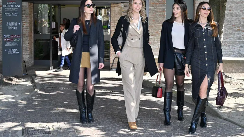
Padua: Small-group walking tour with the Scrovegni Chapel
Best value: the slot and the fresco context in one booking
Check Availability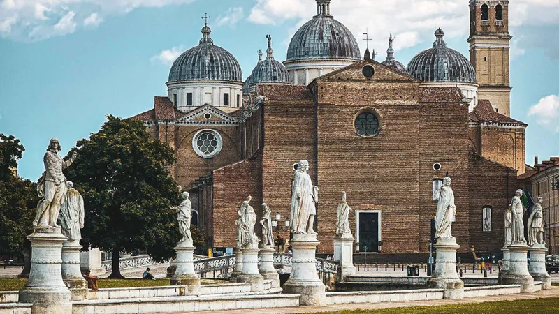 from $69.61
Padua: Experience Padova Like a Local – Guided Tour
The local-life pick: squares, alleys, and a tasting at Pedrocchi or the market
Check Availability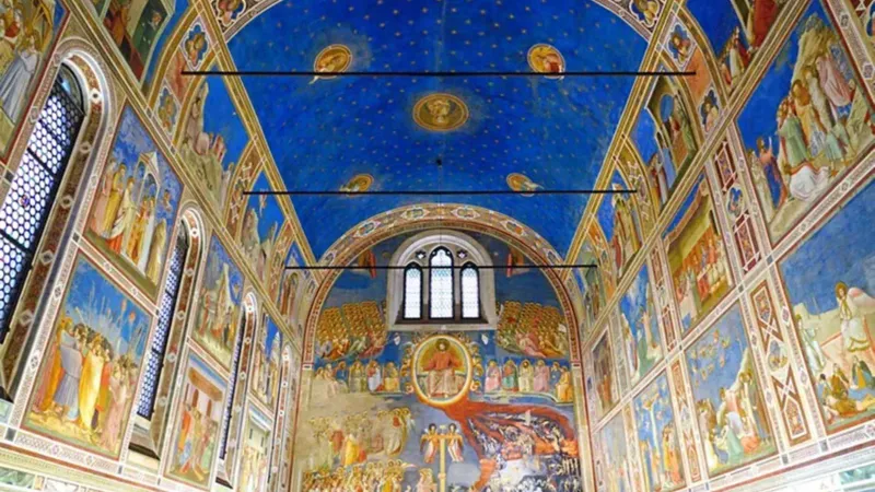 from $45.25
Guided Tour of Giotto's Scrovegni Chapel
The fresco deep-dive with the slot handled for you
Check AvailabilityPrices, ratings and details are the platform's own, checked in Q3 2026; dollar figures are the listed prices — the platform bills in your account's currency.
Frequently asked questions about the Padua map
How do I use this map on a first visit?
Filter to one category at a time — the five colours separate monuments, museums, green space, food and transit, so the 36 pins stay legible. The pin numbers follow a north-to-south arc that matches a single day's walking, and the full version of that sequence is written out on Padua in 1 day. Use the walking-times table as the reality check before you add a fourth quarter to the plan.
Where can I park a car near the old town?
Outside the restricted core. The historic centre is camera-enforced limited traffic, so aim for perimeter garages — the underground parking in the Piazza dell'Insurrezione area is among the closest to the centre — or a park-and-ride on the edge with a tram or bus ride in. Tariffs and zone boundaries change, so confirm through the city tourism portal; the parking section above has the working rules.
Is Padua walkable between the mapped pins?
Yes — the old town is flat and roughly two kilometres end to end. The Santo to the botanical garden takes about 20 minutes with the Prato crossing in between, and nothing inside the walls sits more than about 15 minutes from the market squares. The timed pairs in the walking table above were measured on foot, not estimated from a screen.
Where on the map is Giotto's frescoed chapel?
At the north edge, pin 1: the chapel stands beside the Eremitani museums on the remains of the Roman arena, about four minutes north of the market squares. It is the map's only pin with a hard booking rule — timed 15-minute slots, advance booking advised — and the slot mechanics, prices and queue logic are set out on Scrovegni Chapel tickets.
How far is the railway station from the centre?
Padova Centrale sits about 1.5 kilometres north of the market squares — a 15-to-20-minute walk, or a short tram or bus ride from the forecourt. The station district also holds the bus terminal, the airport-bus stop and the taxi rank, which is why all four pins cluster at the top of the map; the arrival routes are compared on Venice airport to Padua.
Where is the tourist office?
Two IAT desks: the main office at Piazza delle Erbe 52, in the arcades of the market square, and a second in the railway station atrium. Both hand out the free paper city map, sell the Urbs Picta Card and answer opening-hour questions — a conversation that pairs well with the budgets on Padua costs.
Which mapped pin is best at sunset?
Prato della Valle, and it is not a contest: the western canal arc catches the low light and the 78 statues turn warm against it. The Loggia Amulea corner is the photograph, the Lungargine Rovetta is the quiet version, and both sit inside the map's green category. Time the walk to end at a bacaro counter off the squares afterwards.
How does the Urbs Picta Card work with this map?
The card covers eight UNESCO-listed sites — including the chapel and the Salone — plus city transport: €28 for 48 hours or €35 for 72. On the map, that collapses most of the monuments and museums categories to zero marginal cost, while the transit pins carry the transport half. The honest break-even arithmetic is on is the Padua Card worth it.
Reviewed Q3 2026 (July–September 2026); next review Q4 2026. Prices, hours and terms are set by the venue or operator and confirmed at checkout.
We may earn a commission if you book through one of our links, at no extra cost to you. Full affiliate disclosure